The following are links to sample data from the Odyssey2025 humanitarian demining project in Chad. A selection of sample data will be shared from each of the three campaigns due to take place in 2019.
High Resolution Google Earth Files
Not everyone has access to dedicated geographical information system (GIS) software, and fortunately Google Earth can act as a basic GIS display platform for the masses. More information and a link to download a sample file are available here:
http://mr-au.com/google-earth-samples/.
Inspection Imagery
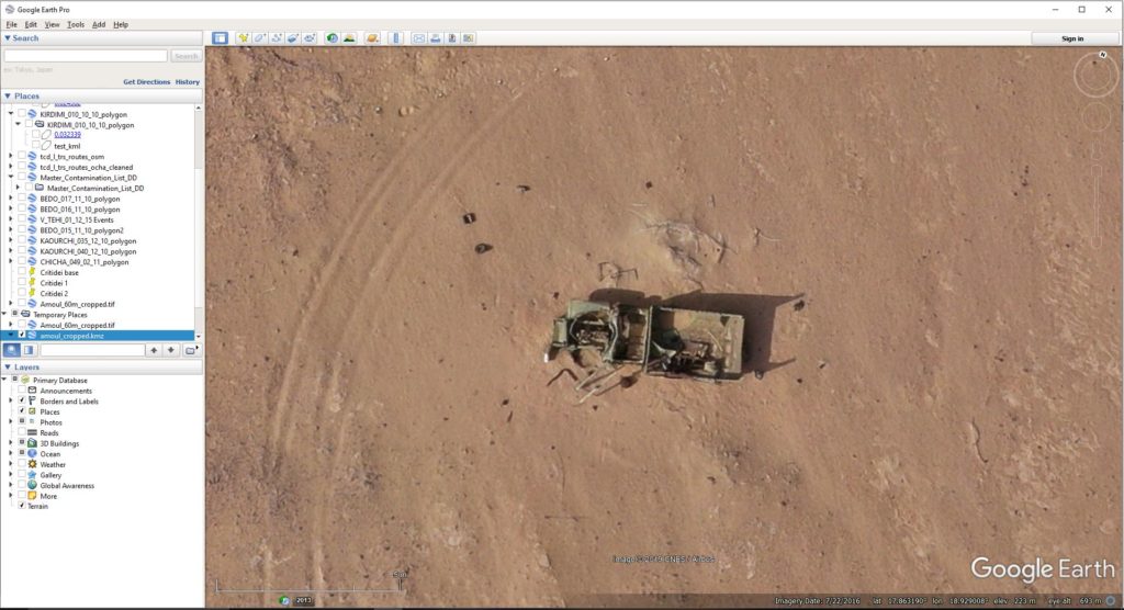
The following are examples of high resolution consumer drone inspection imagery from an accident scene within a confirmed hazardous area (CHA). This took place in a location where technical survey was already underway – for calibration. You can see a technical survey lane marked with red and white painted stones next to the accident location. One of the advantages of the drone is being able fly from outside of the CHA to gather inspection evidence – before it takes perhaps a week (depending on the distance) for a person to open a technical survey lane carefully moving forward with a metal detector to reach the hot spot for an inspection from on the ground.


A set of images from above can be downloaded from here.
Mapping/Cartography Imagery
A process called photogrammetry is used when small drones fly in a set pattern to stitch together hundreds of images to provide an optical map. Similar to Google Earth but at much higher resolution. Topographic and three dimensional reconstructions of the environment are also possible using the same process. Aerial maps help to join the dots between individual evidence points and a wider area.

Images 1 and 2 are individual photos, with Image 3 being a photo map, stitched together from hundreds of overlapping photos. The wider perspective in Image 3 helps to show an important pattern linking accident locations from a row of landmines.